
Recording from the November 22nd meeting. For a comment or input to be included in the official mapping review, it must be submitted by Tuesday November 29th. Comments can be emailed to [email protected]
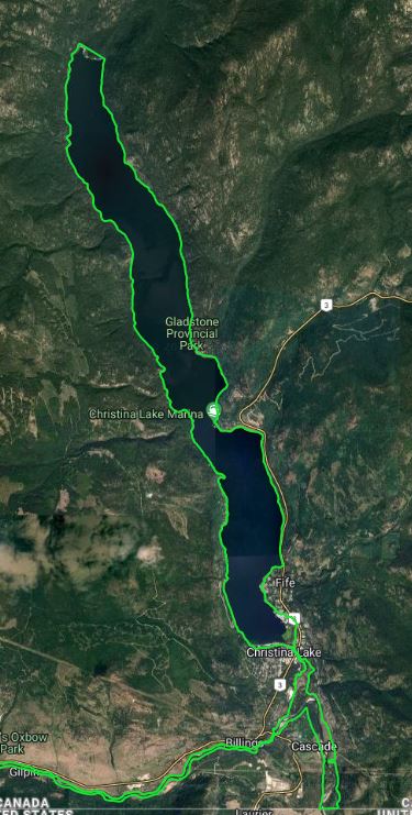
DRAFT Area C floodplain and alluvial fan maps can be downloaded from the two links below:
The draft maps have been removed from the website, as they are now being processed into their final version. Our hope is to have the final version available to the public by summer 2023.
The Public Engagement meeting was held at the Christina Lake Community Hall (90 Park Road, Christina Lake), on Tuesday, November 22, 2022. Meeting layout was:
- 4:00-5:00 Open House
- 5:00-7:00 Presentations: Northwest Hydraulic Consultants (Engineers) and RDKB staff: Donna Dean (Planning and Development), Freya Phillips (Senior Energy Specialist) and Mark Stevens (Emergency Management)
- 7:00-8:00pm Additional time for questions
This was both an in-person and online meeting. The online option was through Zoom (recording shown above).
Floodplain maps are expected to be updated every 10-20 years, or after any major event. Following the high water event in 2018, the RDKB has been aware that they needed to update the floodplain mapping throughout the Boundary Region. In 2020 a flood and geohazard assessment was completed by Ebbwater (report available at https://rdkb.com/Environment/Watershed-Planning) which identified priority areas for assessments. In 2021, the RDKB received approximately $800,000 to start updating the Boundary flood and geohazard maps. As the cost for these flood and geohazard mapping is covered through grants, not all of the Boundary was able to be covered this year. The areas prioritized included:
- Area C: Christina Lake, Christina Creek and Kettle River
- Area D: Kettle River (east of the municipality of Grand Forks)
- Area D: Kettle River (south and west of municipality of Grand Forks)
- Area E: West Kettle River: Carmi to Beaverdell
- Area E: Kettle River: Rock Creek to Midway
Mapping still needing to be completed include:
- Area D: Granby River (north of Municipality of Grand Forks)
- Area E: Kettle River: Rock Creek to Fiva Road
- Area E: West Kettle River: mouth with the Kettle River past Rhone
For permitting and bylaw requirements, the floodplain maps to be referred too are the ones identified in the RDKB Floodplain Bylaws. These new maps are only to be used for permitting purposes after the RDKB Floodplain Bylaw has been updated, endorsed by the RDKB Board and updated on the RDKB website.
The draft Area C maps will be available for download on Tuesday November 22 until Tuesday November 29, 2022.