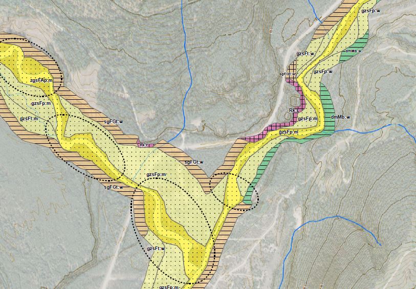
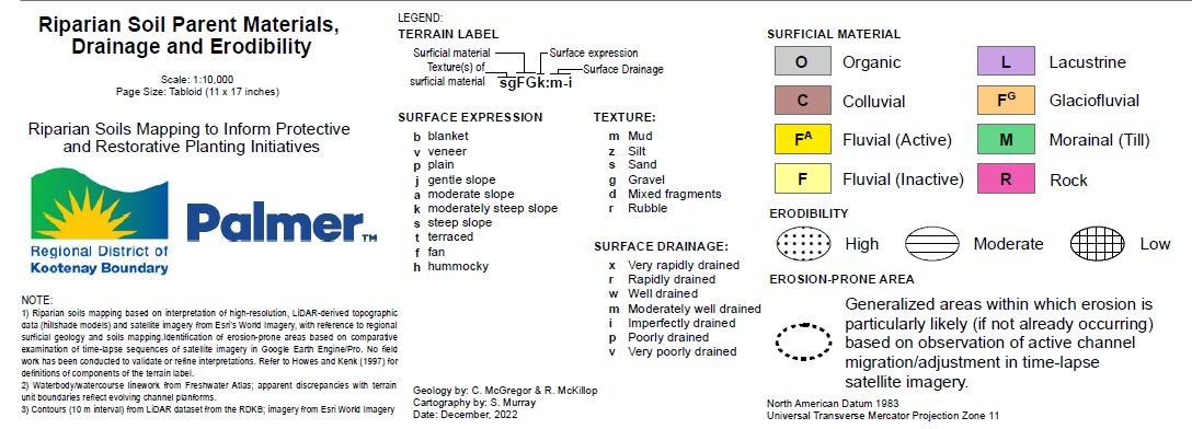
Funded through the Local Government Climate Action Fund, the RDKB hired Palmer TM to complete a desktop study examining the riparian areas through many of our major waterways. Using LiDAR and air photographs, Palmer identified the areas parent material, sensitivity to erosion, disturbance, surface expression and soil texture. The image below is an example of the habitat along Wilkinson Creek (tributary to the left) and the West Kettle River.
Realizing that this work has not been ground verified, this tool has been an excellent resource towards better understanding our at-risk habitats at some of our main surface water systems.
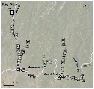
A total of 55 maps were produced covering portions of the West Kettle River, Kettle River, Boundary Creek, Eholt Creek and the Granby River. The image to the left provides the location of the individual map sheets. Due to financial constraints, the areas chosen for this study matched the more detailed assessed areas in the 2021 RDKB Flood and Geohazard Risk Assessment completed by Ebbwater and Palmer.
The RDKB is grateful to the funding from the LGCAF, which made this project possible. For a copy of this report, please contact [email protected].