A big thank you to all of you who entered the 2021 BC Rivers Days draw – telling us what do you do “use water wisely”. What a great mix of ideas! Opportunities that are already happening here in our region. Keep up the great work and for doing your part to be Water Smart!
Images submitted through the BC Raffle – a successful garden while reducing watering substantially.
With the warm temperatures and less than average precipitation, most of the Boundary region has now entered drought level 2 – dry conditions. For Level 2, surface water users are recommended to reduce water withdrawals by 10% of licensed water quantity; for those not licensed, 10% of current use.
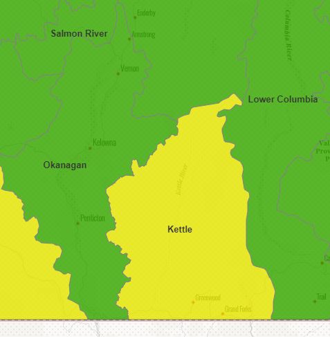
Level 1 (Green) Normal Conditions Level 2 (Yellow) Dry Conditions
Kettle River Watershed: Level 2 (as of August 19, 2020)
Okanagan Basin Watershed: Level 1 (as of August 19, 2020)
Check out the Boundary Region Drought Response Plan (link in the post below) for recommended response at the different drought stages.
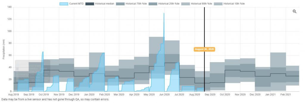
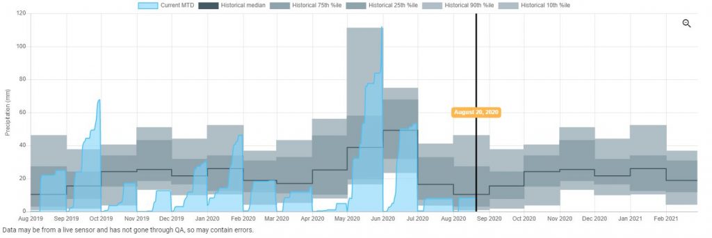
The Boundary region received approximately half of normal precipitation amounts in July: Rock Creek (8 mm) and Grand Forks (9 mm). The precipitation graphs below are from the Kootenay Boundary Water Tool (note: these weather stations are not set up to accurately record winter precipitation).
Grand Forks (No. 392) BC FLNRORD Wildfire Weather StationRock Creek (No. 394) BC FLNRORD Wildfire Weather Station