Category Archives: Current Projects
Frequently Asked Questions:
What is a riparian area?
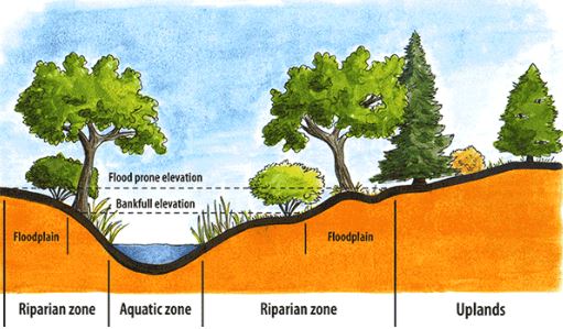
A riparian area is the area of land adjacent to a body of water (ie: streams, creeks, lakes, wetlands, ponds, etc) that plays a crucial role in maintaining water quality, preventing erosion, and providing habitat. It forms a corridor between the land and a body of water, whether the water is flowing or standing. The overall area is made up of three zones: the aquatic zone, the riparian zone, and the upland zone. A healthy riparian area contains diverse plant species and both aquatic and terrestrial wildlife.

The aquatic zone is the water body itself, including the stream bed, banks, and any submerged vegetation. Key features of the aquatic zone include:
– Providing habitat for fish, invertebrates, amphibians, and reptiles
– Supporting aquatic plants like algae, aquatic grasses, and rooted plants
– Playing a vital role in water filtration and nutrient cycling
The riparian zone is the transitional area between the aquatic zone and the upland zone. Key features of the riparian zone include:
– Inclusion of wetlands, marshes, and swamps
– Providing habitat for a variety of wildlife (birds, mammals, and insects)
– Characterized by moisture-loving plants like willows, alders, and cottonwoods
– Helps with bank stability and the prevention of erosion
The upland zone is the higher and drier area that borders the riparian zone. Key features of the upland zone include:
– Can include forests, grasslands, and/or agricultural fields
– Less directly influenced by the water body, but still plays an important role in the overall ecosystem
– Can serve as a buffer that protects the riparian zone from disturbances
Why does this project exist?
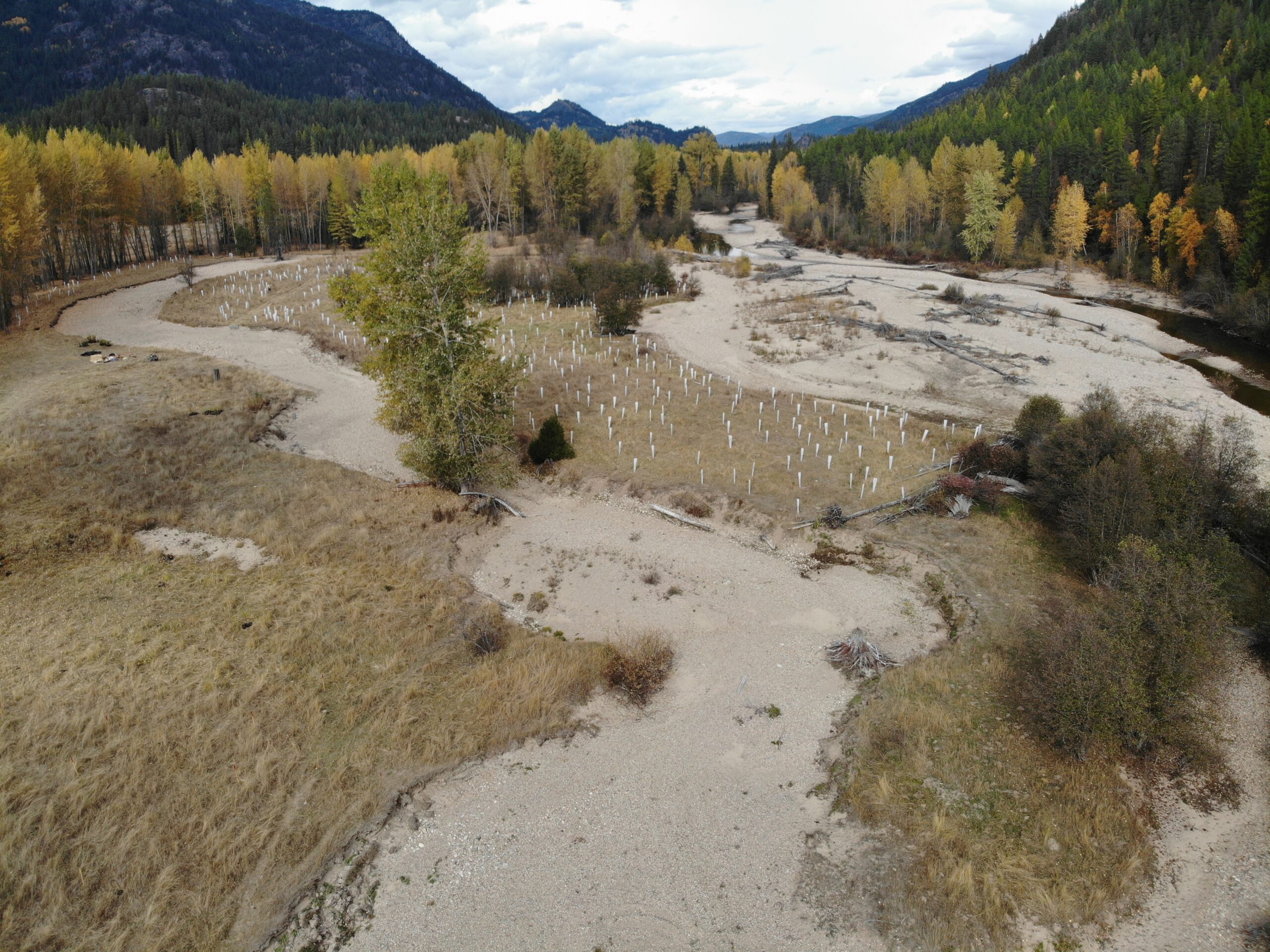
Along waterways the loss of land from erosion, increased sedimentation and loss of habitat is a growing concern in the Boundary. As extreme weather events become the norm, this project aims to identify riparian areas throughout the Boundary that are at risk of future degradation.
What causes a riparian area to be ‘at risk’?
In general, an unhealthy riparian area is one with poor soil quality, little-to-no plant life, and/or no diversity in the plants and wildlife present:
– Poor soil composition in the riparian zone has a higher potential for erosion during high moisture events.
– A lack of both aquatic and terrestrial plant species is an indicator of an unhealthy riparian area. Trees, shrubs, and some grasses use their roots, water uptake ability, and mass to help stabilize the banks and waterways. They play a crucial role in preventing erosion

Why does it matter if a riparian area is at risk?
When a riparian area is lacking these fundamental building blocks (healthy soils, diverse vegetation and wildlife, etc), it holds the potential to cause downstream damage. High water events, such as heavy rain fall or flooding, can move large amounts of sediment downstream. The sediment is deposited in slower-moving areas like floodplains and river bends, forming gravel bars or islands. These formations can alter the flow of water, potentially causing erosion or flooding. Additionally, these new routes can reduce the water depth, leading to increased water temperatures during the summer months. This warmer water can harm fish, invertebrates, and amphibians. The increase of sediment in the water can water quality, hindering vegetative growth and reducing oxygen levels for fish. While a certain amount of sediment movement is necessary for a healthy ecosystem, excessive amounts can have detrimental effects.
What else?
Have you got a question that we missed? Feel free to reach out to [email protected] with your questions!
2024 Riparian Project
The RDKB is grateful to UBCM Community Emergency Preparedness Fund (CEPF) for supporting us with this year’s project to assess and restore riparian areas through the Boundary Region.
This project has three categories, and as of September 2024 all components have contractors working towards their success. We will work on updating this site throughout the project – if you have any questions, don’t hesitate to email Kristina Anderson at [email protected].

Category 1. Rural Riparian Assessment and Ecosystem Services evaluation.
Consultants: Okanagan Nation Alliance (ONA)
Category 2. Community Engagement and Monitoring. Includes a 2-day forum (Spring 2025) Meet Erin Kitchen and Jenny Coleshill, the projects new Communication Coordinators

Category 3. Riparian restoration at the Burrell Creek site
Consultants: EcoLogic Consulting (team photo below – July 2024) & Durand Landscaping

Workshop
The format for the Low Water Irrigation Techniques workshop has been changed from in-person to a video option – providing a resource to watch at your convenience. It will be posted on this page by the end of June. So stay tuned as we talk about some of the ways you can maximize the benefits of the water collected in your rain barrel.
The rain barrel construction portion has been cancelled.

Have questions? Email: [email protected]
Rain Barrel Sale

