Getting out of the office and boardroom to see real-world conditions is a highlight for watershed planners and stakeholders. Members of the Stakeholder Advisory Group, Riparian Working Group, and the Boundary Central Secondary Sustainable Resources 12 students and teacher Lisa Baia looked over riparian conditions at four sites on Boundary Creek Road, Greenwood, and Boundary Creek Provincial Park. Thanks to Fred Marshall for leading us through the tour and to Lisa for arranging the bus and bringing the keen students. Here’s some of the highlights.
Boundary Creek upstream of Boundary Creek Road bridge, just past the end of pavement
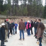
Participants at Boundary Creek Road Bridge
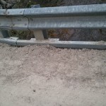
Sand and gravel on the bridge at Boundary Creek Road, just waiting for spring cleanup to reduce sedimentation
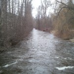
Boundary Creek is moving closer to Boundary Creek Road, just past the end of pavement
Participants at Roylance Rd Bridge
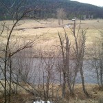
Riparian conditions upstream of Roylance Rd Bridge
Riparian conditions at the confluence of Boundary Creek and Wallace Creek
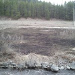
Burning of riparian area at lower Eholt Creek – healthy or unhealthy?